|
Hem/Home
Fakta/Facts
Bana/Line
Fordon/Rolling
stock
Modell/Modelling
Forskning/Research
Länkar/Links
Kontakta/Contact
|
Anläggning/Layout
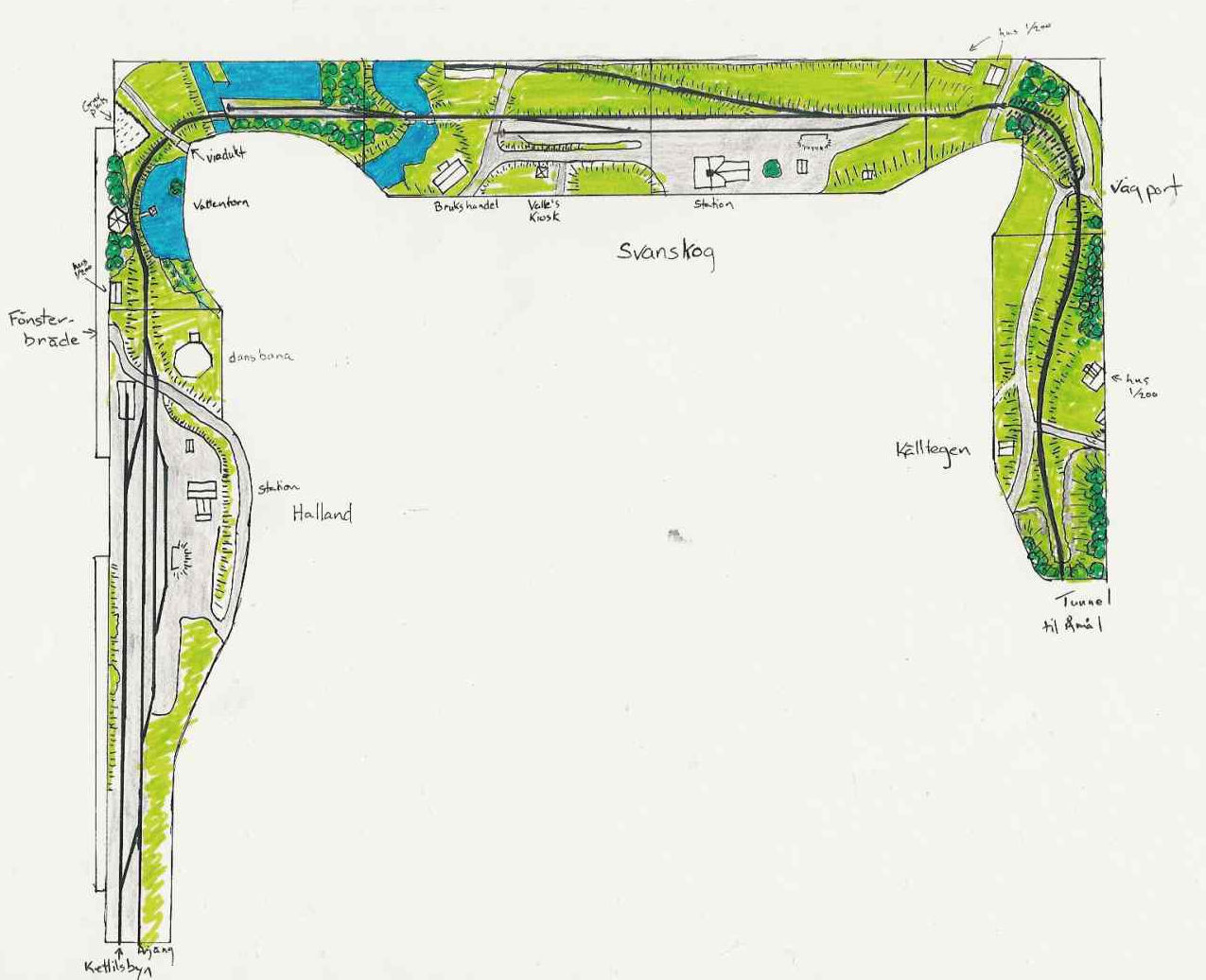
The track plan represents the stretch from Hallanda to Källtegen going
left to right. At each end of the railway will be a movable cassette system which
will allow trains to be staged and stored. At the Hallanda
end, there will be provision for two cassettes: one represents the main line
to Årjäng; and the other the branch line to Kättlisbyn. All the track will be hand-laid code 40 and
the turnouts will be number 9's. At this point, I am planning on using
convention dc wiring.
Currently, the boards for Svanskog,
Källtegen and the two corner boards are built. Hallanda will wait until I have some decent contemporary
pictures of the area. Much of Källtegen has
scenery, but Svanskog is waiting until I fix some
issues with the points.
Track planning
Deciding on which stations to include is always
difficult. Well, Svanskog was a given, but what
else? Sandaholm would make a lovely model, and Sillerud had its attractions, or what about Norane and the narrow gauge line that crossed the railway
there? I pondered this for quite a while, when one day I decided to make a
graphic timetable. This proved to be decisive. It became clear that Hallanda was an important junction in the railway. All
the trains met at Hallanda, and then there was the
branch line to Kättilsbyn. Doing both Svanskog and Hallanda meant
also, in a way, increased fidelity in that they were basically contiguous.
My first track plan differed from the one
presented here in that Svanskog was on the left, Hallanda in the centre and on the short wall on the right
was Kyrkkudden. This allowed for three stations and
a reasonable flow of trackage. But it involved a
number of compromises which I was not happy about: in order for the tracks
leaving for Kättilsbyn and Årjäng
to be in the correct order, i.e. the branch line track further from the front
than the track to Årjäng, I drew Hallanda as a mirror image; also, because the curve
coming into Kyrkkudden was right-handed the turnout
was planned to be the other way and thus avoiding an S-curve.
I wasn't so pleased with the track plan, but it
was something to work with. Then one day, I was looking at an aerial picture
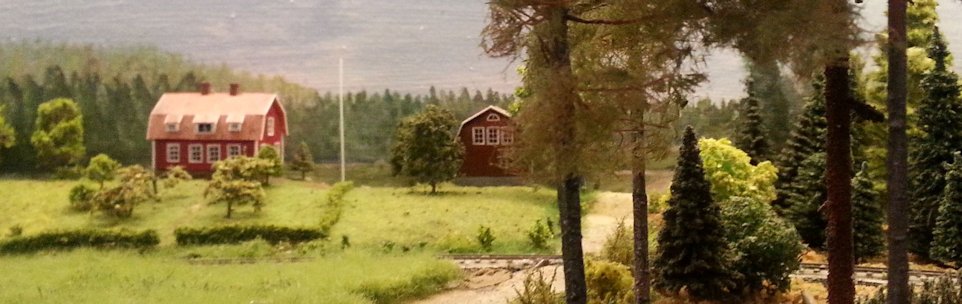
of Svanskog, which I had gotten from Värmland's Museum, and I noticed an extra turnout and
spur by a logging pond. This added a whole new operational interest to Svanskog and was a 'must have'. In order to accommodate
the extra track, I moved Svanskog onto the longer
middle section and Hallanda on to the left. This
immediately dealt with the problem in Hallanda, and
the track orientation is now correct. On the other hand, it led to a problem
of what to do on the short wall. I toyed with the idea of putting Ömmeln there, but that was too tight a squeeze. In the end, I just decided to put Källtegen there “where it's supposed to be". This
allows for greater fidelity, but is also interesting from modelling point of
view: The track runs on an embankment, goes over a small bridge and then,
correctly, exits through a tunnel.
However, I ran into a problem with the corners:
bodies of water and roads met that shouldn't have. The solution, as you can
see from the track plan, was to cut into the corners and eliminate the
offending sections. When I showed this solution to a friend, his initial
reaction was negative; however, now that the segments are built, he has
cottoned onto the idea.
|
|