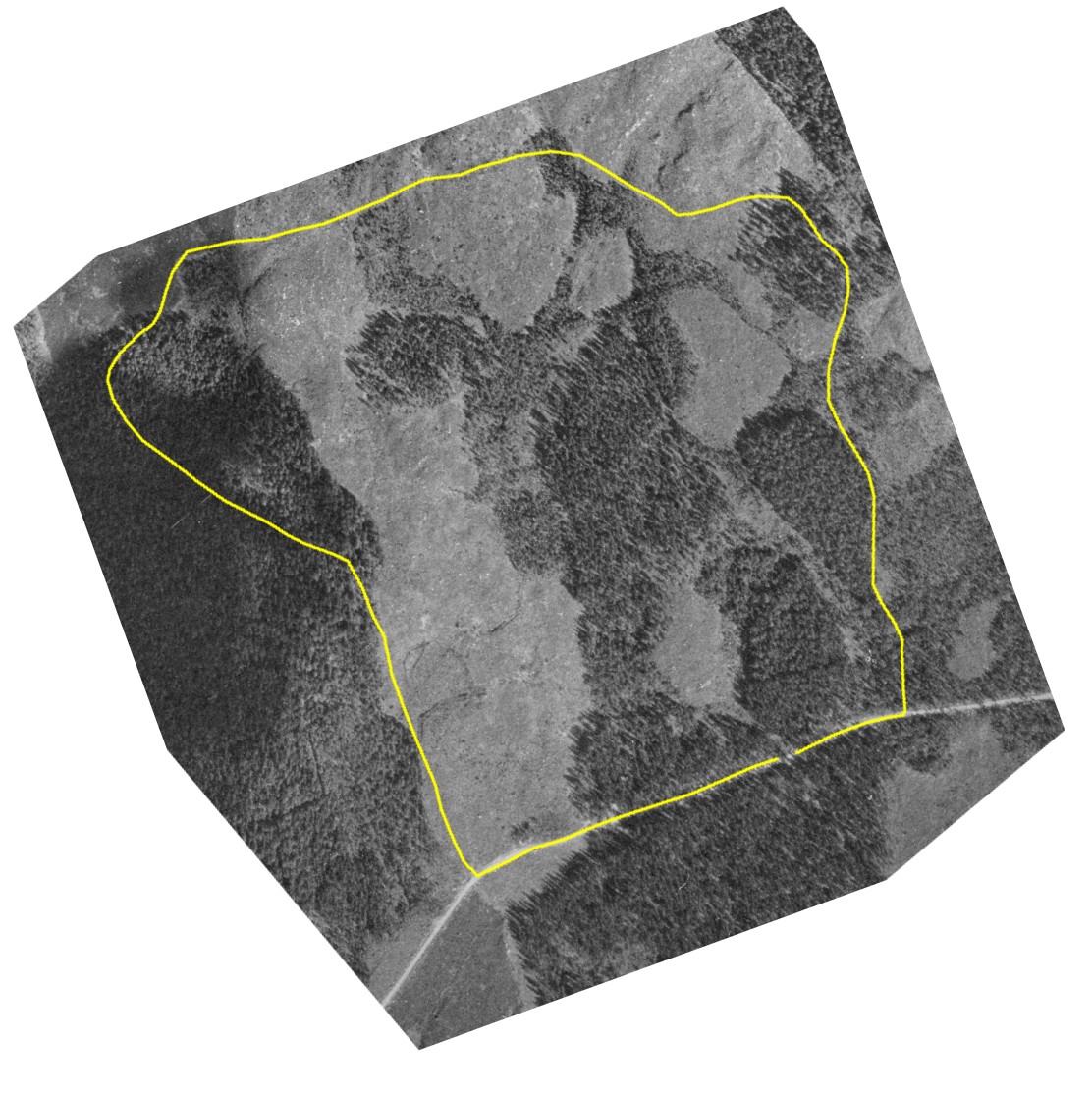
MARV4/2 2007 - Study area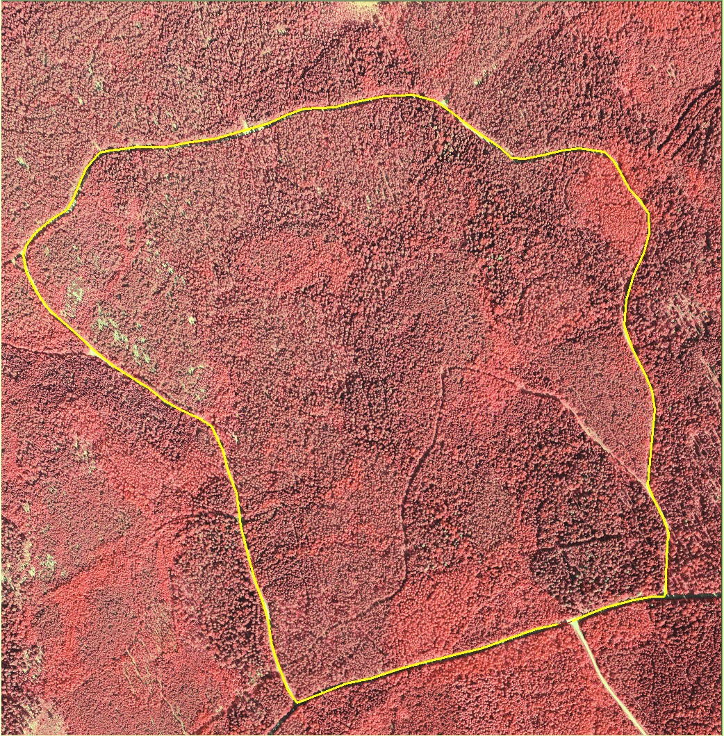
The fictious forest holding in Hyytiälä
is 56.85 hectares in size and comprises naturally and artifially regenerated
stands - mostly on mineral soils. It is surrounded by the Texasin rata and
the Pilkotun tie roads. Polygon that
delineates the area - approximately as it was drawn at the 180 m elevation
from a non-rectified aerial photo.
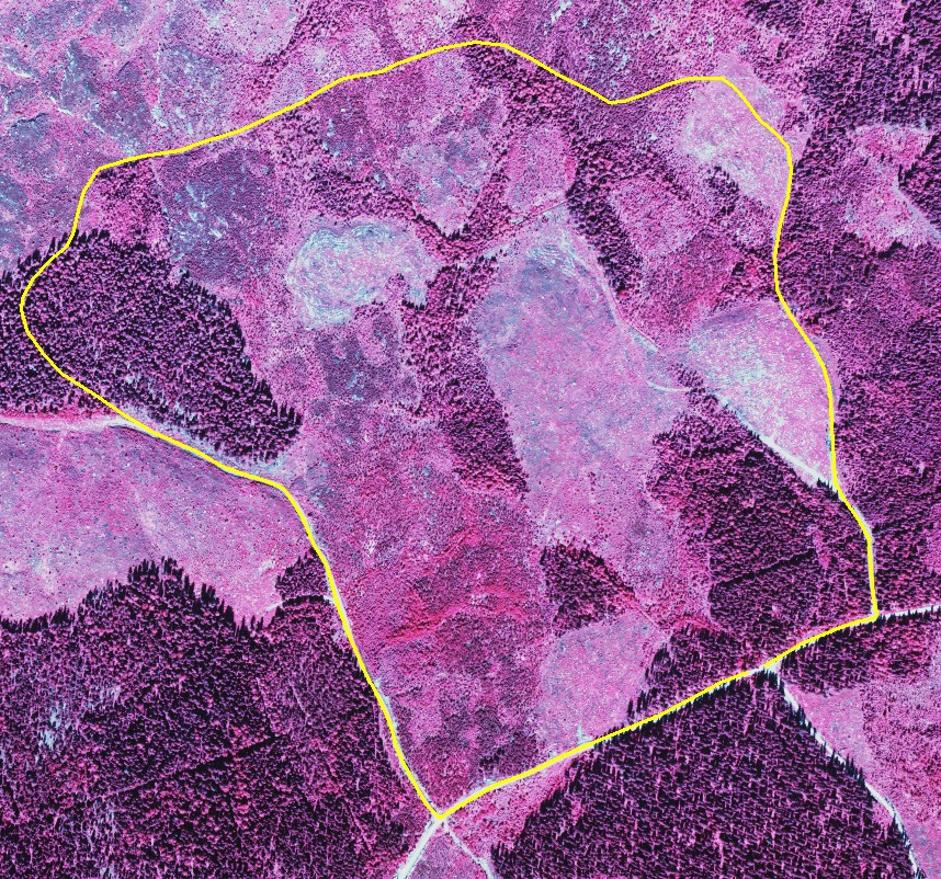
Aerial views of the area in 1962, 1973 and 1985. The 1985 photo indicates that youngest stands are from realy 1980s. The largest old growth, Kalelan Kuusikko, is in the SE corner. 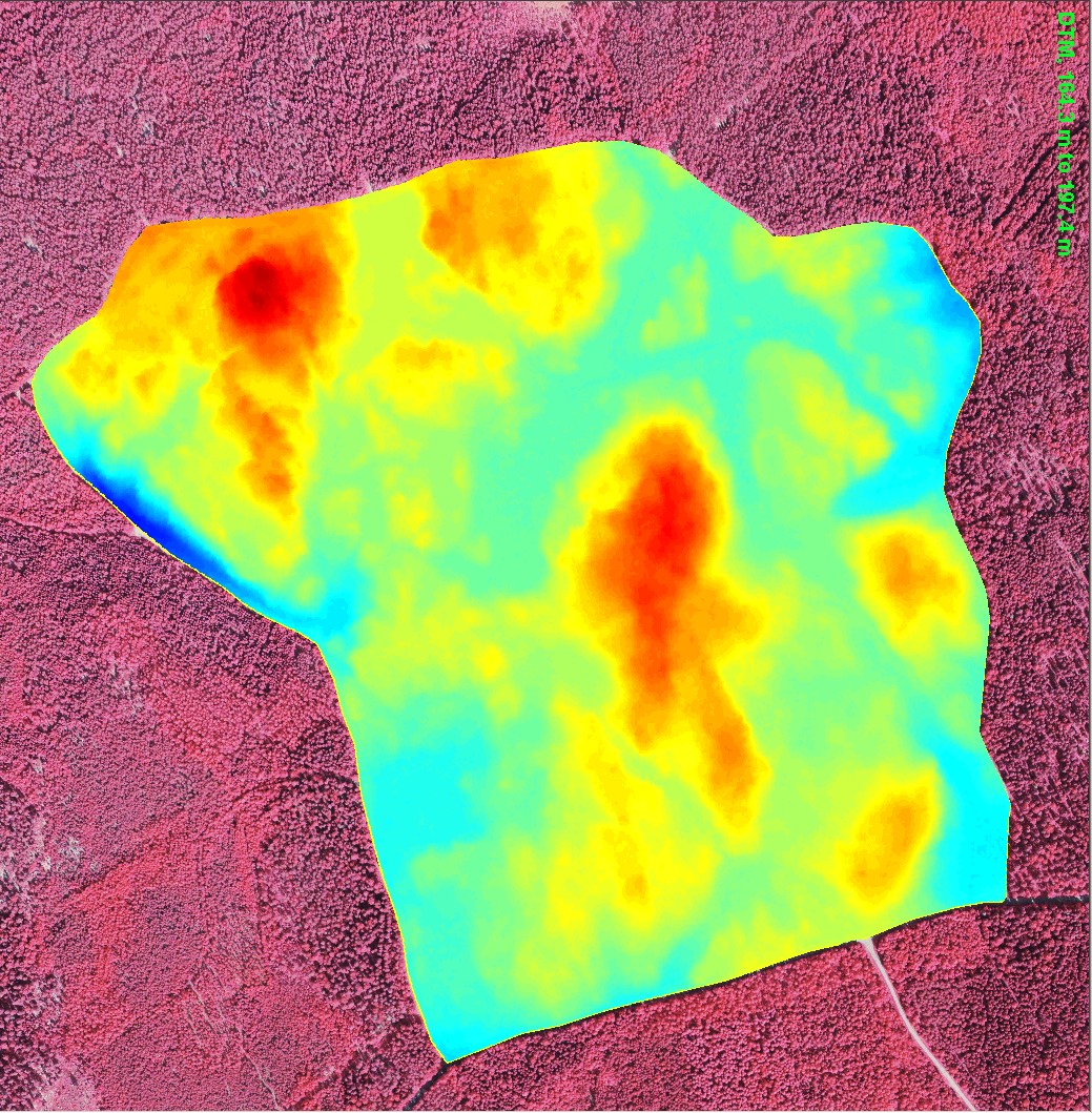
|
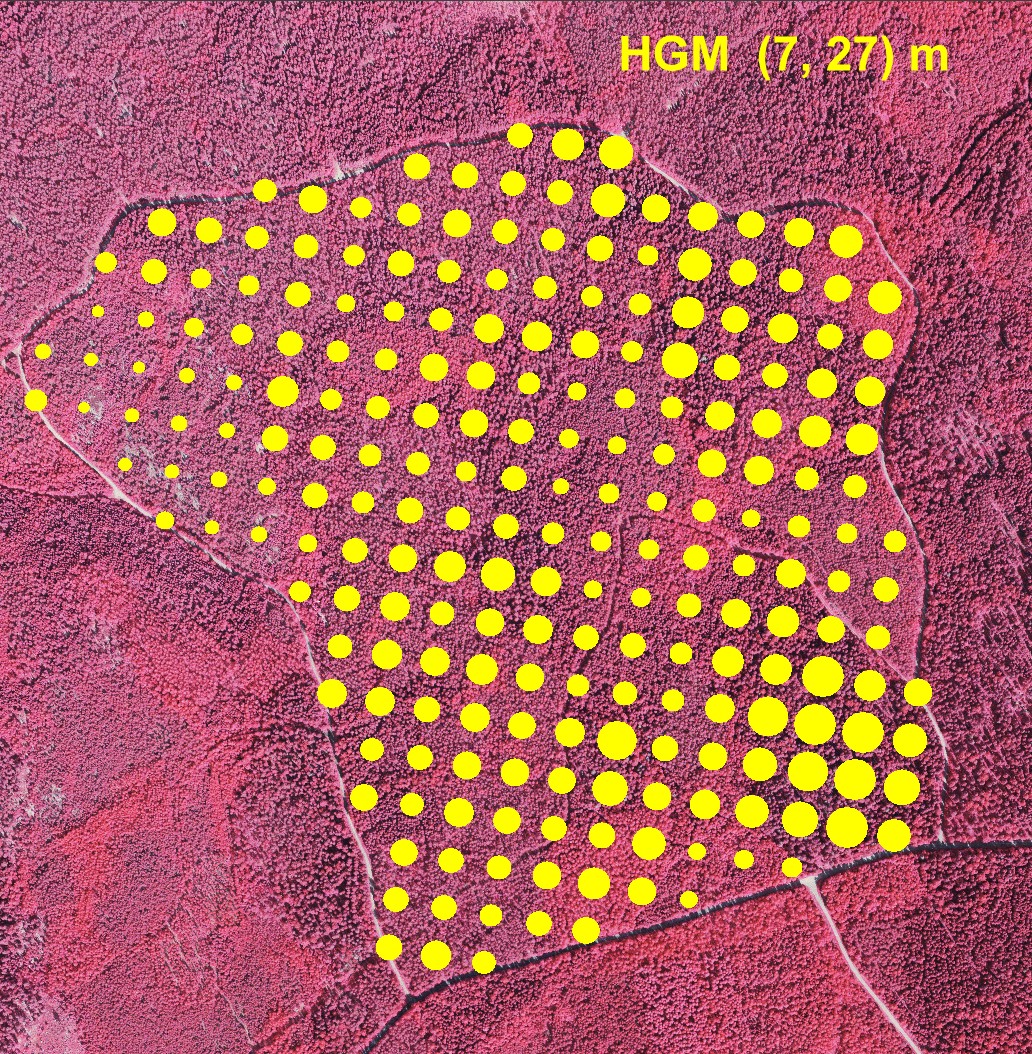
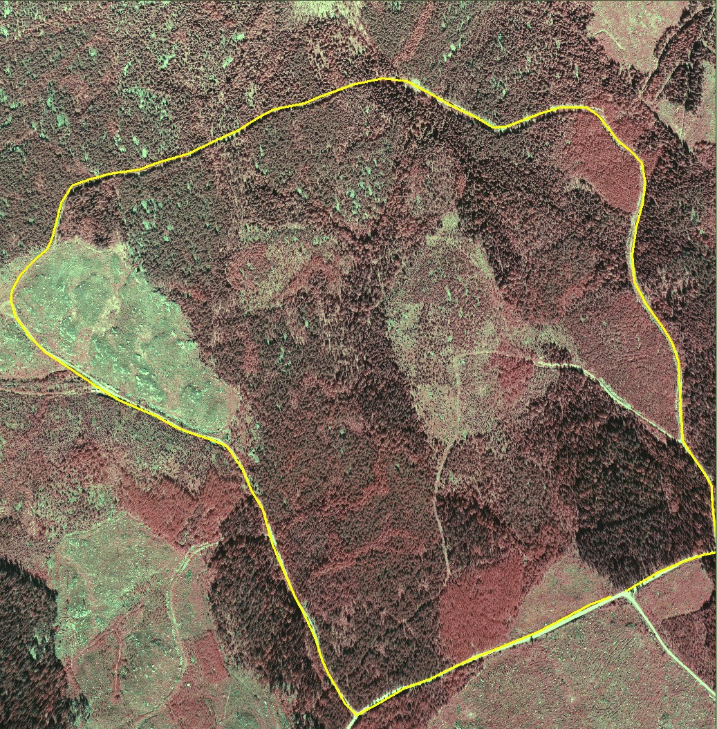
LiDAR from 2004 was used here to produce a map of
basal-area median height (HGM) in a systematic 50 x 50 m grid. The method
is described in Suvanto
et al. 2005. It is based on the properties of the cumulative height distribution
of LiDAR points that form the explanatory variables for regression modeling.
The mean height ranged from 7 to 27 meters in a set of 224 plots with a radius
of 7.99 meters.
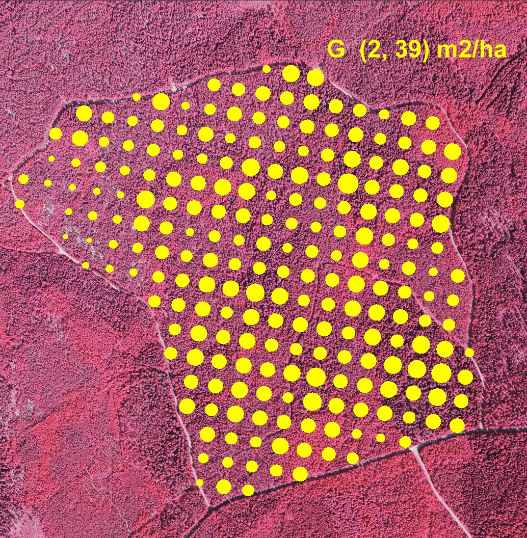
LiDAR-based estimates of basal area. Regression estimation
method of Suvanto et al. 2005. The basal area ranged ed from 2 to 39 m2/ha
in a set of 224 plots having a radius of 7.99 meters.
|