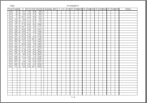
The plotfiles.zip package has the photo-trees in 59 ascii-files. Some of the the information in the files is redundant and not needed in the field. In the field we will use forms for storing the observations. Fig 1. shows an example that can be used as a model in the preparation of the forms.
Fig. 1. (Click to enlarge). The ascii-files were filtered and values for the variables: Plot-ID, tree-ID, Species, Photogrammetric height, Lidar-Dcrm, Distance from plot center, Azimuth from plot center and the InOut indicator remain in the form. Columns were added for species, status, dbh, h, hc and Dcrm. Four series of columns for ID, distance and azimuth were added for field positioning using trilateriation/triangulation. Last column is for notes.
The sample excel-file is here. In it, the page settings for the A4-paper were adjusted such that the print will be "in landscape", the margins, header and footer were set also. The first line with the column headings is printed on each page. The records were sorted according to the InOut indicator and tree number - the photo-trees that do not belong to the plot are also included on the "bottom rows". There are blank rows for the complementary measurements of non-seen trees and remeasured trees.
